
Project Ruby conducts seismic surveys in 3D
Three-dimensional seismic mapping will help show whether South Lolland can become the center of cutting-edge CO2 storage. Citizens are invited to an information meeting.
The Rødby area could play a key role in the green transition if advanced 3D seismic technology shows that the Lolland subsoil is suitable for safe geological storage of CO2. The seismic surveys cover an area of 220 square kilometers from Søllested and Holeby in the north to Kramnitse, Rødbyhavn and Hyldtofte in the south.
Behind the survey is CarbonCuts A/S with Project Ruby, which in June 2024 was awarded an exploration license by Lars Aagaard, Minister for Climate, Energy and Utilities.
Already in late summer, CarbonCuts invited to the first public meetings to inform about the project and involve everyone in the Rødby area in the exploration plans. One of the activities that CarbonCuts has been busy planning in recent months is the upcoming 3D seismic surveys, which will take place in February 2025. To this end, CarbonCuts has invited citizens in the exploration area to an information meeting on Thursday, December 5.
Safe and realistic
In 2023, GEUS – the Geological Survey of Denmark and Greenland – carried out 2D seismic surveys in the same areas on Lolland. Already then, the studies showed that there were good opportunities for a CO2 storage facility. These studies are the background for the license that CarbonCuts has been granted for further studies.
– Standard seismic surveys have already pointed to South Lolland as a possibility. But that is not enough. We are in the process of detailed planning of the new 3D seismic surveys, which will help us understand whether it is a realistic and safe option, says Charlotte Laurentzius, Exploration Manager at CarbonCuts.
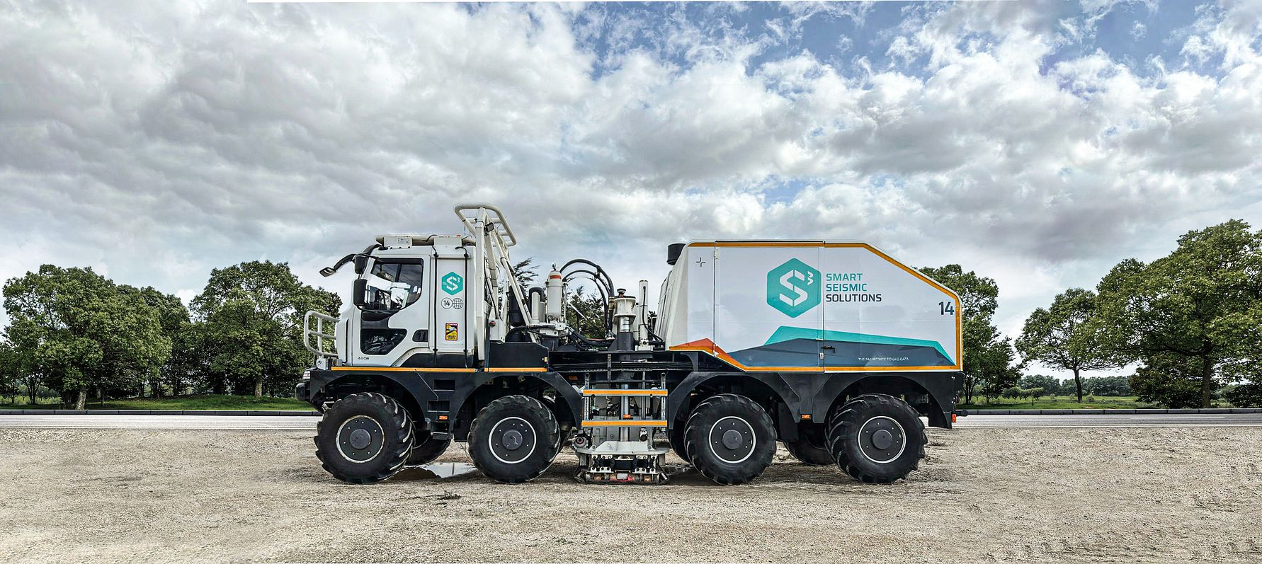
With this project, the Rødby area can be a frontrunner in the fight against climate change – for the benefit of both Denmark and the local community. CarbonCuts is working closely with subsurface experts from GEO, who are carrying out the 3D survey together with Smart Seismic Solutions. The survey is planned in dialog with local authorities and in accordance with applicable environmental and safety standards.
Underway after New Year
The 3D seismic survey is an important part of Project Ruby. The aim is to map the geological structure of the subsurface in three dimensions and investigate whether the area is suitable for safe storage of CO2.
CarbonCuts will start the investigations after New Year when Project Ruby, in collaboration with GEO’s seismic specialists, will send special vehicles with vibration equipment through the area.
Information meeting in Holeby
CarbonCuts and GEO invite all interested parties to an information meeting where the 3D seismic surveys in the local area will be presented and local citizens can get answers to their questions about the survey.
Letter of consent in e-Boks
CarbonCuts also asks everyone in the Rødby area to respond as soon as possible to the e-Boks letter they have received from GEO and CarbonCuts regarding consent for CarbonCuts to perform 3D seismic in the area. Many have already given consent, and at the same time, GEO employees have visited many residents in the area to inform them about the survey, which will take place in February 2025.
Obtaining consent is a legal requirement and a standard regulatory process when conducting seismic surveys. For those who have not yet given consent and want more information before doing so, it is also possible to give consent at the information meeting on December 5.
FACT BOX
What are 3D seismic surveys?
Using controlled vibrations sent into the ground, CarbonCuts can create a detailed three-dimensional image of the subsurface, showing different geological layers and their thickness. The vibrations are mild and pose no risk to buildings, animals or people. The data helps us determine whether the subsurface has the necessary geological structure to safely store CO2.
The surveys will take place from early February 2025 and last approximately 30 days. The vibratory vehicle will follow a carefully planned route with the utmost consideration for all citizens and any vulnerable buildings or installations in the area. In the areas where the vibratory vehicle will operate, you will typically feel vibrations in the ground for 10-20 minutes when the vehicle passes your home. The driving is usually done during the daytime so as not to disturb your sleep at night. The seismic equipment is moved along the route as the work progresses to minimize disturbance to residents.
A green future for Lolland?
CO2 storage is a technology that is already being used around the world as an effective way to reduce the amount of greenhouse gases in the atmosphere. If South Lolland proves suitable, it could be one of the first places in Denmark to actively contribute to this effort.